- Depth : 0.1
- Made In USA : Yes
- Made in the Midwest : Yes
- Model No : M137
- ProductID : 0000000035208
- Restricted Locations : This item cannot be shipped to: AK CA HI
- SkuId : 001217660
- Width : 6.0
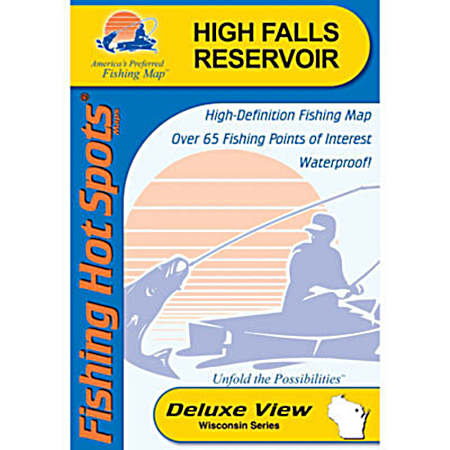
This Fishing Hot Spots Map covers High Falls Flowage in Marinette County, Wisconsin. High Falls is the third largest body of water in Northeastern Wisconsin. It is an excellent smallmouth producer, but quality walleye and muskie also hang out here.
- Durable & waterproof
- Color-coded marked fishing areas
- GPS waypoints & grid
- Lake profile with shaded contours
- Fishery information
- Fishing tips & techniques
- 8 boat access points with driving directions
- 58 proven fishing areas marked
- Made in the USA
- Weight: Approximately .06 pounds
- Shipping Dimensions: Approximately 9.25 x 6 x .1 inches.
- Product details, including packaging, labels, and instructions, are provided by the manufacturer and may differ from what appears on our website. Always read the label, warnings, and instructions before use.