- Depth : 1.0
- Model No : 010-C1368-30
- ProductID : 0000000261730
- Restricted Locations : This item cannot be shipped to: AK CA HI
- SkuId : 100807027
- Width : 5.3
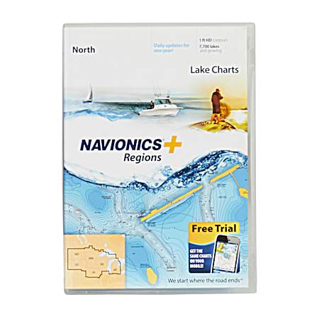
Navigate with confidence using Navionics Plus North Region Map Card Lake Charts. This comprehensive cartography solution provides detailed marine and lake data perfect for fishing, cruising and sailing. Preloaded with nautical and sonar information covering lakes across North Dakota, South Dakota, Minnesota, Wisconsin, Iowa and Michigan, with one year of updates included.
- Detailed cartography for 7,500+ lakes
- Preloaded nautical and sonar data
- One year of updates and Community Edits
- Chart layering capability for enhanced navigation
- Compatible with most Navionics and Lowrance devices
- Product details, including packaging, labels, and instructions, are provided by a third party and may differ from what appears on our website. Always read the label, warnings, and instructions before use.
- Weight: Approximately: 0.2 pounds
- Shipping Dimensions: Approximately: 5.3 x 1.0 inches.