- Depth : 0.6
- Model No : 010-C1366-30
- ProductID : 0000000245182
- Restricted Locations : This item cannot be shipped to: AK CA HI
- SkuId : 100659413
- Width : 5.6
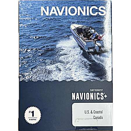
Navigate with confidence using Navionics Map Card Marine & Lake Charts covering All US & Coastal Canada. This comprehensive digital nautical chart eliminates the need for multiple cards with complete maritime coverage in one electronic package. Access free updates, Sonar Charts, and Community Edits for a full year to ensure you have the most current navigational information for your boat adventures on ocean, sea and inland waters, with NOAA-quality precision plus enhanced features.
- Preloaded with all USA and Coastal Canada charts
- 1 ft. HD contours for precise GPS navigation and accurate depth mapping
- Coverage of 18,000 lakes and growing
- Includes card reader for computer use
- Compatible with most Navionics and Lowrance fish locators and chart plotters for sail and powerboats
- Product details, including packaging, labels, and instructions, are provided by a third party and may differ from what appears on our website. Always read the label, warnings, and instructions before use.
- Weight: Approximately: 0.2 pounds
- Shipping Dimensions: Approximately: 5.6 x 0.6 inches.